Lake Mead, September 2026
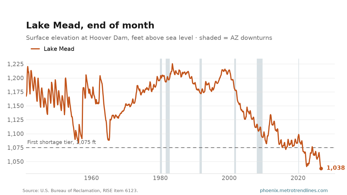
Lake Mead stood at 1,037.8 feet above sea level at Hoover Dam at the end of September 2026, 19.5 feet lower than a year earlier. That is 37.2 feet below the 1,075-foot line marked on the chart. Since January 1941, the highest month-end is 1,225.4 feet, in July 1983; this month is the lowest in that record.
Arizona’s share of the Colorado River reaches Phoenix through the Central Arizona Project canal, which draws from Lake Havasu below Lake Mead, and Arizona takes the largest cut when Lake Mead falls below the shortage line.
The line on the chart is not a trigger by itself. A shortage year is declared each August from the agency’s projection of where the lake will stand the following January 1, so the reading on any one month-end only says which way that projection is leaning. The level rises and falls with the season as well: releases downstream peak in summer, and the spring runoff upstream arrives months later. Compare a month with the same month a year earlier.
Source: U.S. Bureau of Reclamation, Lower Colorado Hydrologic Database, daily elevation at Hoover Dam, last reading of each month. Provisional data. Auto-generated each build.